Mt Tokachidake · Routes
↘ Tokachidake — Ansei Crater
This route carries serious backcountry hazards. Its slope and ATES labels are planning estimates; they do not decide whether it is safe today or suitable for your group.
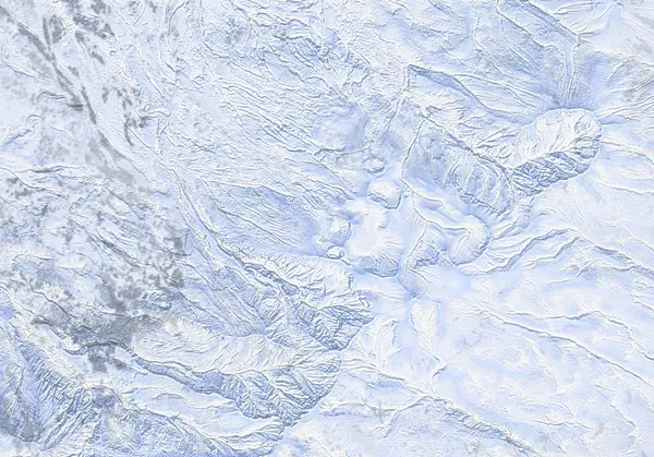 出典:国土地理院
Steepness · profile
← Distance 4.7 km →
Per-segment terrain (data table)
| % | m | Steepness | Aspect |
|---|---|---|---|
| 0% | 1270 | 41° | W |
| 3% | 1288 | 42° | SW |
| 6% | 1294 | 11° | N |
| 10% | 1303 | 17° | NW |
| 13% | 1321 | 23° | NW |
| 16% | 1340 | 24° | NW |
| 19% | 1361 | 33° | W |
| 23% | 1393 | 32° | W |
| 26% | 1418 | 43° | SW |
| 29% | 1417 | 50° | S |
| 32% | 1432 | 35° | W |
| 35% | 1453 | 29° | NW |
| 39% | 1482 | 36° | NW |
| 42% | 1532 | 45° | NW |
| 45% | 1627 | 45° | NW |
| 48% | 1546 | 40° | N |
| 52% | 1488 | 30° | NW |
| 55% | 1455 | 30° | N |
| 58% | 1431 | 50° | W |
| 61% | 1420 | 42° | S |
| 65% | 1464 | 38° | SW |
| 68% | 1537 | 47° | SW |
| 71% | 1581 | 46° | S |
| 74% | 1510 | 36° | S |
| 77% | 1469 | 30° | SW |
| 81% | 1426 | 36° | W |
| 84% | 1386 | 27° | W |
| 87% | 1347 | 24° | W |
| 90% | 1327 | 20° | W |
| 94% | 1306 | 11° | SW |
| 97% | 1295 | 38° | NW |
| 100% | 1290 | 38° | SW |
Route guide
[Check the restriction first] Tokachidake is an active volcano under JMA Volcanic Alert Level 2 (~1.5 km no-entry ring around the 62-2 crater, since June 2026). The Ansei (Nukkakushi) crater valley lies OUTSIDE the published ring — the track's closest point is about 1.7 km from the 62-2 crater — but the boundary is not far above the head of the valley, and any change to the alert level or the restricted radius changes everything. The live JMA restriction always overrides any historical route line: confirm the current bulletin before you go.
[Route overview] The Ansei Crater (~1450 m) is a steaming, geothermally active gully at the head of the valley east of Ryounkaku Onsen in the Tokachidake Onsen area, beneath the crag-bound western wall of Kamihorokamettoku-yama (1920 m). A plowed public parking area at ~1270 m puts complex alpine terrain within a small day: roughly 500 m of cumulative climbing over ~5 km and ~4 hours. This is not a single line but an exploratory zone — compact, relatively protected, sometimes steep bowls and gullies on either side and at the head of the valley, lapped as conditions allow. Baked maximum slope is ~57° (short pitches along the rock walls), median ~27°. Given fresh snow and light wind it is a smorgasbord of steep, lappable skiing.
[Getting in] From the public carpark beside Ryounkaku Onsen head east, keeping high along the summer-trail line, to where it crosses the Nukkakushi-Furano River; from there follow the valley east to the 'crater' — in truth a steaming stretch of gully. Return the way you came.
[Hazards specific to this valley] (1) Volcanic gas: the Ansei crater is an active fumarole area; SO2/H2S is colourless, pools in hollows and the valley floor, and can reach dangerous concentrations on calm days — never enter steaming hollows, stay upwind. (2) Rockfall and cornice fall off the walls: the valley is ringed by walls steep enough to be a winter-climbing venue; rock, ice and avalanches off them run to the valley floor. (3) Terrain traps: the valley floor and gullies are deposition zones — even a small slide buries deep. In March 2026 a size-2 wind slab in this Ansei / Sandan-yama area fully buried a ski tourer. (4) The zone is entirely alpine and extremely condition-dependent.
[Navigation] This is a good-visibility valley. In gas cloud or ground blizzard you are in a cul-de-sac walled by crags, fumaroles and the restriction boundary; pushing too far east at the valley head brings you toward the no-go ring. Verify with GPS and compass, and check both the live JMA volcano bulletin and the JAN Central Hokkaido avalanche bulletin before any tour. A description of terrain, not a recommendation.
Access & logistics
[Restriction check — first] Tokachidake is at JMA Volcanic Alert Level 2 (since June 2026). The Ansei valley currently sits outside the published ring, but the boundary is close — confirm the live JMA volcano bulletin before every tour. The live restriction always overrides the historical line.
[Start & parking] The large plowed public parking area beside Ryounkaku Onsen (Tokachidake Onsen, ~1270 m) — one of Hokkaido's highest trailheads, buying alpine terrain for little climbing.
[Getting there] Take the prefectural road from Kami-Furano up to Tokachidake Onsen road-end. Expect ice and snow; public transport is limited, so a car is the practical option.
[Snow & kit] Entirely alpine and highly condition-dependent. Beacon, shovel and probe are mandatory; treat every gully and the valley floor as a terrain trap. Check the JAN Central Hokkaido bulletin (3x weekly).
[After] Ryounkaku, Kamihoroso and Hakuginso are all nearby — some of the best onsen in Hokkaido. Confirm hours locally.
Trip plan
Terrain (auto)
Slope-based estimate — not an official ATES rating.
Today's conditions
…
All values are estimates. Defer to official avalanche + weather bulletins.
Avalanche bulletin (read first)
Today's danger rating + avalanche rose (aspect/elevation) come from the official bulletin — check it before you go.
Pre-trip checklist
Hokkaido Wilds · Rob Thomson — HokkaidoWilds.org · CC BY-SA 4.0
Route data source: Rob Thomson — HokkaidoWilds.org · CC BY-SA 4.0 · ↓ Download GPX