Mt Tokachidake · Routes
↘ Tokachidake — Bogakudai approach
This route carries serious backcountry hazards. Its slope and ATES labels are planning estimates; they do not decide whether it is safe today or suitable for your group.
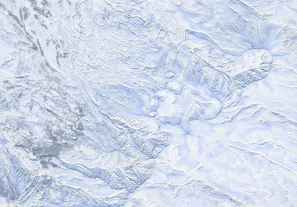 出典:国土地理院
Steepness · profile
← Distance 15.5 km →
Per-segment terrain (data table)
| % | m | Steepness | Aspect |
|---|---|---|---|
| 0% | 933 | 24° | E |
| 3% | 982 | 25° | N |
| 6% | 1052 | 15° | W |
| 10% | 1114 | 22° | NW |
| 13% | 1230 | 31° | NW |
| 16% | 1310 | 37° | W |
| 19% | 1407 | 32° | NW |
| 23% | 1455 | 34° | N |
| 26% | 1480 | 47° | NE |
| 29% | 1428 | 48° | NW |
| 32% | 1497 | 49° | S |
| 35% | 1674 | 42° | N |
| 39% | 1869 | 56° | NW |
| 42% | 2049 | 51° | W |
| 45% | 2002 | 56° | E |
| 48% | 1958 | 56° | SW |
| 52% | 1877 | 34° | S |
| 55% | 1798 | 25° | SE |
| 58% | 1819 | 33° | W |
| 61% | 1908 | 36° | SE |
| 65% | 1977 | 25° | E |
| 68% | 2002 | 39° | NE |
| 71% | 2013 | 39° | NW |
| 74% | 1841 | 28° | NW |
| 77% | 1786 | 40° | NW |
| 81% | 1735 | 36° | N |
| 84% | 1552 | 39° | NW |
| 87% | 1392 | 40° | W |
| 90% | 1271 | 22° | NW |
| 94% | 1148 | 19° | N |
| 97% | 1075 | 21° | W |
| 100% | 1012 | 25° | N |
Route guide
[CRITICAL — RESTRICTION] Tokachidake is an ACTIVE VOLCANO. Since June 2026 the Japan Meteorological Agency (JMA) has maintained Volcanic Alert Level 2 (crater-vicinity restriction), with a roughly 1.5 km no-go radius around the 62-2 crater. That no-go zone PUTS THE SUMMIT ITSELF INSIDE the restriction, so the standard Bogakudai-to-summit line is CLOSED and the summit is not an objective. The line enters the no-go zone above roughly 1300 m — do not go above it. Always check the live JMA volcano bulletin and the JAN (Japan Avalanche Network) Central Hokkaido bulletin before you set out.
The Bogakudai approach starts on the Biei/Shirogane side at the Bogakudai parking area (~930 m; 142.6499E, 43.4476N) and, in normal conditions, climbs the northwest flank (aspect NW) toward the summit for about 1140 m of vertical over roughly 16 km one way. A maximum slope of about 57° is recorded, but that figure includes short steep volcanic-wall sections and does not represent the angle of the skin line. Under the current restriction, touring is limited to roughly below 1300 m, on the open mudflow and scoria fan.
Even that lower fan demands respect. Above treeline it is featureless, wind-scoured volcanic gravel with almost no reference points, and in gas or ground blizzard it produces severe whiteout. This is also the source terrain of the 1926 (Taisho) lahar (mudflow), so treat the ground as both volcanic and avalanche terrain. The Tokachidake Refuge Hut serves as a mid-mountain landmark.
[Volcano-specific hazards] The closer you approach the restricted zone, the more the volcanic hazards bite. Hot ground melts thin snow from below and can leave hidden steam voids beneath the surface — break through one and you risk burns or a fall. Volcanic gas (SO2 / H2S) pools in lee terrain and hollows; it can be colourless and odourless yet cause acute poisoning. Near the summit and craters the ground reaches around 300°C in places, so simply being there can be fatal. These are the direct reasons the restriction exists.
[Descent caution — aspect and whiteout] Tokachidake, like the other volcanic cones in this range, presents near-identical, featureless slopes on every aspect up high. In flat light (overcast or gas that erases all shadow and texture) it is easy to mistake the northwest face you climbed for another aspect and ski onto the wrong one — a recurring accident here every season. Always confirm your descent bearing with compass / GPS, and do not ski blind in poor visibility.
This is not a managed slope; it is an active volcano and the whole route is avalanche terrain. Read this as a description of the ground and the restriction, not a recommendation, and act only on your own stability assessment, a current restriction check, and your own judgement.
Access & logistics
[Trailhead & parking] The route starts on the Biei / Shirogane side at the Bogakudai parking area (~930 m; 142.6499E, 43.4476N). In winter, usable parking depends on snow-clearing, so check current local conditions before committing to a plan.
[Restriction check — mandatory] Tokachidake is at JMA Volcanic Alert Level 2 (crater-vicinity restriction, since June 2026). A ~1.5 km radius — which includes the summit — is closed, and the standard Bogakudai line enters that no-go zone above roughly 1300 m. Always confirm the current restriction extent and alert level on the JMA volcano bulletin before you set out; the level and the restriction can change.
[Getting there] Approach Bogakudai from the Biei / Shirogane-onsen direction. Expect snow and ice on the roads — a 4WD vehicle with winter tyres or equivalent is appropriate. Public transport is limited and infrequent, so confirm options in advance.
[Where you can go] For now, touring is limited to the open mudflow / scoria fan below roughly 1300 m. Given the volcanic gas, hot ground and hidden steam voids, do not enter the restricted zone under any circumstances.
[After] Onsen and food are found around the Biei / Shirogane-onsen area. Hours and openings vary by season, so confirm locally.
Trip plan
Terrain (auto)
Slope-based estimate — not an official ATES rating.
Today's conditions
…
All values are estimates. Defer to official avalanche + weather bulletins.
Avalanche bulletin (read first)
Today's danger rating + avalanche rose (aspect/elevation) come from the official bulletin — check it before you go.
Pre-trip checklist
Hokkaido Wilds · Rob Thomson — HokkaidoWilds.org · CC BY-SA 4.0
Route data source: Rob Thomson — HokkaidoWilds.org · CC BY-SA 4.0 · ↓ Download GPX