Rishiri-zan · Routes
↘ Rishiri — Pon-yama
This route carries serious backcountry hazards. Its slope and ATES labels are planning estimates; they do not decide whether it is safe today or suitable for your group.
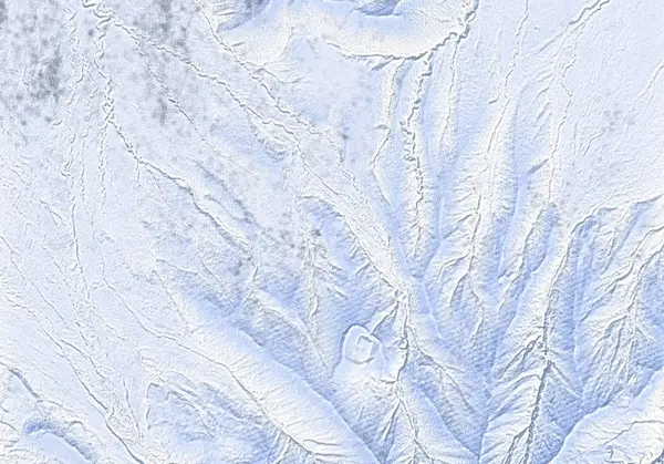 出典:国土地理院
Steepness · profile
← Distance 7.2 km →
Per-segment terrain (data table)
| % | m | Steepness | Aspect |
|---|---|---|---|
| 0% | 49 | 13° | NE |
| 3% | 63 | 19° | NW |
| 6% | 77 | 6° | N |
| 10% | 92 | 6° | N |
| 13% | 107 | 6° | N |
| 16% | 124 | 8° | N |
| 19% | 142 | 9° | N |
| 23% | 166 | 9° | NW |
| 26% | 180 | 9° | NE |
| 29% | 201 | 9° | NW |
| 32% | 222 | 12° | NW |
| 35% | 248 | 21° | NW |
| 39% | 266 | 21° | NE |
| 42% | 305 | 23° | S |
| 45% | 357 | 27° | S |
| 48% | 421 | 32° | SE |
| 52% | 448 | 32° | W |
| 55% | 421 | 27° | SE |
| 58% | 357 | 23° | S |
| 61% | 304 | 21° | S |
| 65% | 267 | 21° | NW |
| 68% | 248 | 12° | NW |
| 71% | 223 | 9° | NW |
| 74% | 201 | 9° | N |
| 77% | 181 | 9° | N |
| 81% | 166 | 9° | NW |
| 84% | 142 | 8° | N |
| 87% | 124 | 6° | N |
| 90% | 107 | 6° | N |
| 94% | 92 | 6° | N |
| 97% | 77 | 19° | N |
| 100% | 63 | 13° | NW |
Route guide
Pon-yama (444 m) is the rounded hump behind Oshidomari township — 'pon' is Ainu for 'small'. Of the island's several Pon-yamas, this one, the only one without a qualifying place-name, is the highest at 444 m. Its south slope is a front-row seat for the full sweep of Rishiri-zan: a ~7.2 km, ~374 m, ~3 hour round trip with a baked maximum slope of ~28° — the gentlest ski tour on the island. Ideal for beginners, or as the banker tour for days when wind makes Rishiri-zan impossible (this record was in fact skied on the afternoon of a Rishiri-zan retreat).
[The route] From Rishiri-Fuji Onsen follow the snowed-in road toward Hokuroku Campground, wrap around the back (west side) of Pon-yama, and climb the open, treeless, sheltered south-facing slope. Signposts are sporadic, in Japanese, and bury in big snow — assume you are navigating yourself. From the summit: Rishiri-zan filling the southern sky, the Sea of Japan and Oshidomari harbour to the north. The natural descent is the open slope you climbed. Some guidebooks show a line north off the summit direct to Oshidomari, but the trees are dense — returning the way you came is the practical choice.
[Caution] Small mountain, real Rishiri wind — and the island has no avalanche bulletin. The ~28° maximum is borderline ground in avalanche terms: respect wind-loaded pockets and the small stream gully (a 'steep-ish drop down to stream' is waypointed ~1.9 km in). The spring-water point and the campground buildings are useful landmarks if weather moves in. A description of the ground, not a recommendation.
Access & logistics
[Start] Rishiri-Fuji Onsen in Oshidomari (~1.5 km on foot from the ferry terminal); parking available.
[Ferry] Heartland Ferry Wakkanai–Oshidomari (Jan–Apr: 6:55 and 13:55, ~¥2,500 each way). A day trip is possible; the Rishiri Green Hill Inn is the classic overnight base.
[Navigation] Signposts are sporadic and often buried — carry GPS. In deteriorating weather the campground–onsen road is the reliable way home.
[Avalanche info] Rishiri has no avalanche bulletin. Carry beacon, shovel and probe even on a small hill.
[After] The route starts and ends at Rishiri-Fuji Onsen (¥500; winter hours noon–9pm, closed Mondays).
Trip plan
Terrain (auto)
Slope-based estimate — not an official ATES rating.
Today's conditions
…
All values are estimates. Defer to official avalanche + weather bulletins.
Avalanche bulletin (read first)
Today's danger rating + avalanche rose (aspect/elevation) come from the official bulletin — check it before you go.
Pre-trip checklist
Hokkaido Wilds · Rob Thomson — HokkaidoWilds.org · CC BY-SA 4.0
Route data source: Rob Thomson — HokkaidoWilds.org · CC BY-SA 4.0 · ↓ Download GPX