Weisshorn · Routes
↘ Weisshorn — East Ridge
This route carries serious backcountry hazards. Its slope and ATES labels are planning estimates; they do not decide whether it is safe today or suitable for your group.
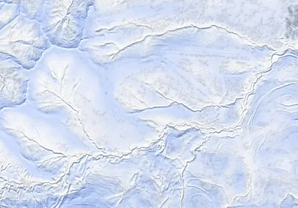 出典:国土地理院
Steepness · profile
← Distance 7.6 km →
Per-segment terrain (data table)
| % | m | Steepness | Aspect |
|---|---|---|---|
| 0% | 517 | 20° | NW |
| 3% | 519 | 15° | W |
| 6% | 520 | 13° | W |
| 10% | 523 | 13° | NE |
| 13% | 526 | 15° | N |
| 16% | 530 | 13° | SE |
| 19% | 561 | 20° | SE |
| 23% | 613 | 22° | SE |
| 26% | 647 | 22° | E |
| 29% | 699 | 31° | E |
| 32% | 771 | 24° | E |
| 35% | 823 | 22° | S |
| 39% | 884 | 22° | S |
| 42% | 946 | 29° | S |
| 45% | 989 | 31° | E |
| 48% | 1030 | 37° | SW |
| 52% | 1035 | 37° | NE |
| 55% | 1025 | 35° | N |
| 58% | 1018 | 28° | SE |
| 61% | 977 | 22° | SE |
| 65% | 922 | 22° | S |
| 68% | 860 | 25° | SE |
| 71% | 803 | 31° | E |
| 74% | 741 | 28° | NE |
| 77% | 677 | 22° | E |
| 81% | 635 | 20° | N |
| 84% | 594 | 20° | E |
| 87% | 549 | 13° | SE |
| 90% | 529 | 15° | SE |
| 94% | 527 | 13° | NE |
| 97% | 520 | 9° | NE |
| 100% | 519 | 20° | W |
Route guide
The East Ridge climbs Weisshorn — a 1045 m peak NNW of Niseko United (Hanazono) — as an out-and-back up its eastern ridge. Hokkaido Wilds gives ~7 km, ~500 m, ~3 hours. The bake reads the aspect as east (E), with a line median of ~17°, a maximum of ~38°, and an ATES rating of 'complex.' Read this as a description, not a recommendation.
[Terrain] From the end of snow clearing on Route 58, drop down the minor road to the right for about 1 km (~20 min), then veer left off the road onto the ridge and follow the east ridge the whole way up. The forest opens to alpine slopes around 750 m; from a ~1000 m ridge a flat ~300 m traverse leads to the summit. Infrastructure from the defunct Weiss ski area remains. Waypoints mark 'Cut up onto ridge,' '974,' 'Knob' and 'Cat Skiing Area.'
[The main hazard is navigation] The source names the primary risk plainly: navigation above treeline in low visibility. 'Dropping down the wrong ridge or bowl on Weisshorn will lead skiers off in completely different directions.' The summit sheds ridges and bowls radially, so in flat light (cloud or fog) it is easy to descend into a drainage other than the one you climbed. Carry reliable navigation and confirm your descent bearing. Check the Niseko avalanche bulletin and the JAN SW Hokkaido bulletin before departing, and make your own stability assessment.
Access & logistics
Start & parking: The winter end-of-plowing on Route 58, ~5 km from the Hanazono ski resort (access point: 42.9006°N, 140.6647°E). Roadside space depends on plowing.
Getting there: A car is the practical option, from the Hanazono (Niseko United) side. Expect snow and ice in winter — 4WD with winter tyres.
The day: ~7 km, ~500 m, ~3 hours — down the minor road ~1 km, then up the east ridge, descending the ascent line.
Info: Check the Niseko avalanche bulletin and the JAN SW Hokkaido bulletin before departing.
Trip plan
Terrain (auto)
Slope-based estimate — not an official ATES rating.
Today's conditions
…
All values are estimates. Defer to official avalanche + weather bulletins.
Avalanche bulletin (read first)
Today's danger rating + avalanche rose (aspect/elevation) come from the official bulletin — check it before you go.
Pre-trip checklist
Hokkaido Wilds · Rob Thomson — HokkaidoWilds.org · CC BY-SA 4.0
Route data source: Rob Thomson — HokkaidoWilds.org · CC BY-SA 4.0 · ↓ Download GPX