Tarumae-zan · Routes
↘ Tarumae-zan — Lake Shikotsu Route
This route carries serious backcountry hazards. Its slope and ATES labels are planning estimates; they do not decide whether it is safe today or suitable for your group.
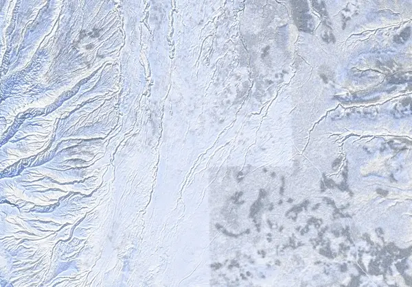 出典:国土地理院
Steepness · profile
← Distance 15.6 km →
Per-segment terrain (data table)
| % | m | Steepness | Aspect |
|---|---|---|---|
| 0% | 304 | 6° | W |
| 3% | 322 | 9° | NE |
| 6% | 347 | 7° | N |
| 10% | 360 | 7° | NW |
| 13% | 379 | 10° | E |
| 16% | 398 | 14° | NW |
| 19% | 404 | 10° | NW |
| 23% | 423 | 7° | NE |
| 26% | 455 | 7° | N |
| 29% | 491 | 8° | NE |
| 32% | 528 | 9° | NE |
| 35% | 567 | 8° | NE |
| 39% | 610 | 21° | NE |
| 42% | 667 | 25° | NW |
| 45% | 824 | 37° | NE |
| 48% | 935 | 37° | SE |
| 52% | 1023 | 37° | E |
| 55% | 932 | 36° | SE |
| 58% | 818 | 25° | NE |
| 61% | 664 | 21° | N |
| 65% | 609 | 8° | N |
| 68% | 565 | 9° | NE |
| 71% | 527 | 8° | NE |
| 74% | 489 | 7° | NE |
| 77% | 454 | 7° | N |
| 81% | 421 | 11° | NE |
| 84% | 402 | 14° | N |
| 87% | 397 | 10° | NE |
| 90% | 379 | 7° | E |
| 94% | 360 | 7° | W |
| 97% | 346 | 9° | NW |
| 100% | 322 | 6° | N |
Route guide
The Lake Shikotsu route climbs Tarumae-zan — a smoking 1023 m active volcano on the south rim of the Shikotsu caldera — as an out-and-back, starting with a long forest-road approach from the winter road-closure point. Hokkaido Wilds gives ~15.7 km, ~687 m, and a difficulty of 5/10. The bake reads the aspect as northeast (NE), with a line median of just ~6° (mostly gentle road approach), a maximum of ~38°, and an ATES rating of 'complex.' Read this as a description, not a recommendation.
[Terrain] The winter start is the junction of Route 141 and Route 276 by Lake Shikotsu — nowhere near the summer trailhead and 7th-Station hut. A long forest road and low-angle slopes lead up; past the 7th-Station hut (emergency use only) the forest opens onto the slopes below the outer rim. An almost perpetual wind strips the upper ridges of snow, so most parties depot skis part way and put on crampons for ice and exposed rock.
[The no-go crater] The lava dome around the summit is marked 'No-go zone' on the GPX itself. This is a JMA-monitored active volcano; the fumaroles and volcanic gas are a hazard distinct from avalanche. Keep away from the dome.
[The main hazards are navigation and wind] The source names the primary risks plainly: navigating 'featureless' terrain above the hut in low visibility, and 'fierce' wind exposure on treeless slopes. Flat light makes it easy to lose your bearing — carry reliable navigation. Check the JMA Tarumae-zan volcano bulletin and the Japan Avalanche Network before departing, and make your own stability assessment.
Access & logistics
Start & parking: The Route 141 / Route 276 junction by Lake Shikotsu, ~40 km south of Sapporo. Roadside space depends on winter plowing.
Getting there: A car is the practical option, from the Lake Shikotsu side. Expect snow and ice in winter — 4WD with winter tyres.
The day: ~15.7 km, ~687 m — mostly a long forest-road approach; up high most parties depot skis and put on crampons. Descend the ascent line.
Gear: Carry crampons (ice and exposed rock) and reliable navigation for fierce wind and low visibility.
Info: Check the JMA Tarumae-zan volcano bulletin and the Japan Avalanche Network before departing.
Trip plan
Terrain (auto)
Slope-based estimate — not an official ATES rating.
Today's conditions
…
All values are estimates. Defer to official avalanche + weather bulletins.
Avalanche bulletin (read first)
Today's danger rating + avalanche rose (aspect/elevation) come from the official bulletin — check it before you go.
Pre-trip checklist
Hokkaido Wilds · Rob Thomson — HokkaidoWilds.org · CC BY-SA 4.0
Route data source: Rob Thomson — HokkaidoWilds.org · CC BY-SA 4.0 · ↓ Download GPX