Izari-dake · Routes
↘ Izari-dake — East Ridge
This route carries serious backcountry hazards. Its slope and ATES labels are planning estimates; they do not decide whether it is safe today or suitable for your group.
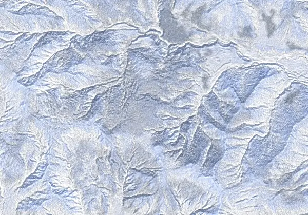 出典:国土地理院
Steepness · profile
← Distance 11.4 km →
Per-segment terrain (data table)
| % | m | Steepness | Aspect |
|---|---|---|---|
| 0% | 538 | 40° | NE |
| 3% | 553 | 38° | NE |
| 6% | 566 | 45° | NE |
| 10% | 579 | 43° | N |
| 13% | 610 | 43° | N |
| 16% | 634 | 37° | E |
| 19% | 679 | 42° | SE |
| 23% | 709 | 39° | N |
| 26% | 811 | 30° | NE |
| 29% | 845 | 27° | NW |
| 32% | 899 | 34° | E |
| 35% | 938 | 34° | NE |
| 39% | 952 | 37° | N |
| 42% | 1042 | 37° | NE |
| 45% | 1112 | 38° | SE |
| 48% | 1170 | 24° | SW |
| 52% | 1197 | 42° | SE |
| 55% | 1307 | 40° | E |
| 58% | 1193 | 31° | SE |
| 61% | 1159 | 37° | S |
| 65% | 1069 | 37° | N |
| 68% | 959 | 42° | E |
| 71% | 943 | 34° | NE |
| 74% | 896 | 29° | E |
| 77% | 841 | 31° | E |
| 81% | 795 | 39° | N |
| 84% | 706 | 39° | N |
| 87% | 663 | 42° | NE |
| 90% | 613 | 43° | NW |
| 94% | 592 | 45° | N |
| 97% | 566 | 39° | NE |
| 100% | 559 | 40° | N |
Route guide
The East Ridge climbs Izari-dake — the 1318 m high point of the northwest Lake Shikotsu caldera rim, just west of Eniwa-dake — as an out-and-back up the ridge from a forestry road on the east side. Hokkaido Wilds gives ~11 km, ~790 m, a difficulty of 7/10, and a round trip of four hours or less, making it a half-day tour within reach of Sapporo. Yet the bake reads the aspect as northeast (NE), with a line median of ~30° — among the steepest in this roster — a maximum of ~46°, and an ATES rating of 'complex' with a release area near 26%. For its modest vertical, the pitch and the density of avalanche terrain run high. Read this as a description, not a recommendation.
[Terrain] From the forestry-road start on the east side (parking near 42.818°N, 141.283°E), skin roughly 2 km up the road, then gain the ridge and climb through trees to the summit. The source describes a steep pitch below the summit that is 'good kick-turn practice,' and the bake likewise shows high-30s to 46° up top. The northeast-facing ridge and slopes sit on the lee of the northwest monsoon — an aspect that loads with wind slab.
[The main hazard is wind-loaded complex terrain] ATES complex with a ~26% release fraction is a high density of avalanche terrain for a mountain of this size. The half-day, low-vertical framing invites complacency, but a 30°-median northeast slope is a classic lee-loaded aspect — watch for slab development. The open forest and ridge on the caldera rim make navigation hard in a whiteout, and no dedicated avalanche bulletin covers the Shikotsu area. Check the Japan Avalanche Network before departing and make your own stability assessment. Izari-dake is not an active volcano, so no volcano bulletin applies.
Access & logistics
Start & parking: The forestry-road start on the east side (parking near 42.818°N, 141.283°E). Plowing and space depend on conditions.
Getting there: A car is the practical option, from Sapporo toward Lake Shikotsu. Expect snow and ice in winter — 4WD with winter tyres.
The day: ~11 km, ~790 m, a round trip of four hours or less — a half-day. The first ~2 km follows the forestry road; then gain the ridge to the summit and descend the ascent line.
Gear: Ski crampons help on the steep pitch below the summit. Carry full avalanche gear and reliable navigation for the wind-loaded northeast slopes.
Info: No dedicated avalanche bulletin covers the Shikotsu area — check the Japan Avalanche Network before departing.
Trip plan
Terrain (auto)
Slope-based estimate — not an official ATES rating.
Today's conditions
…
All values are estimates. Defer to official avalanche + weather bulletins.
Avalanche bulletin (read first)
Today's danger rating + avalanche rose (aspect/elevation) come from the official bulletin — check it before you go.
Pre-trip checklist
Hokkaido Wilds · Rob Thomson — HokkaidoWilds.org · CC BY-SA 4.0
Route data source: Rob Thomson — HokkaidoWilds.org · CC BY-SA 4.0 · ↓ Download GPX