 出典:国土地理院 · © OpenStreetMap contributors / OpenSkiMap (ODbL)
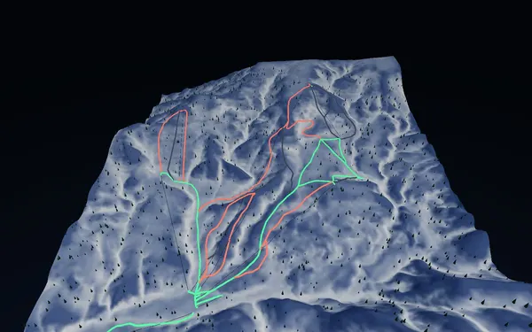
Kiroro · 3D map
Kiroro trail map and mountain guide
See how the Asari, Nagamine and Yoichi sectors fit together before following the live trail board.
- Elevation range
- 477–1,298 m
- Mapped vertical
- 821 m
- Run lines
- 37
- Lift lines
- 10
Terrain and trail structure
SnowWind’s Kiroro trail map is a three-dimensional reading of the resort’s GSI terrain and OpenStreetMap ski features. The baked extent runs from roughly 477 to 1,298 metres elevation, giving about 821 metres of mapped vertical. It currently contains 37 run lines and ten lift lines, with 17 green, 12 red and eight black source classifications. The model helps explain the separation between the Asari, Nagamine and Yoichi sectors, and how gondola or express-lift corridors reconnect to the base.
Course names such as Asari Dynamic, Asari Panorama, Nagamine 1 and 2, Center and Yoichi provide anchors when switching between 3D and the official flat map. The relatively large black share in the source snapshot does not mean every visible slope is skiable. Difficulty, tree-run access, boundaries and closures are controlled by current resort information. Use the model to understand shape and distance, then use the official live status for decisions.
Access and useful season
Kiroro is in Akaigawa, approached by winter road travel and seasonal transport from regional hubs. Routes and reservations change, so consult the resort’s current access page before committing to a connection. The winter operating period is the relevant season for this trail map. Midwinter and later-season visits can present different snow, wind and visibility, and no static guide can identify the best day. Compare your ability with the open-course list, allow time to learn the three-sector layout, and keep the official map available because the SnowWind model is not live navigation.