 出典:国土地理院 · © OpenStreetMap contributors / OpenSkiMap (ODbL)
Kamui Ski Links · 3D map
Kamui Ski Links map and terrain guide
A compact mountain near Asahikawa with a clear vertical profile and varied mapped pistes.
- Elevation range
- 70–794 m
- Mapped vertical
- 724 m
- Run lines
- 36
- Lift lines
- 6
Reading the Kamui map
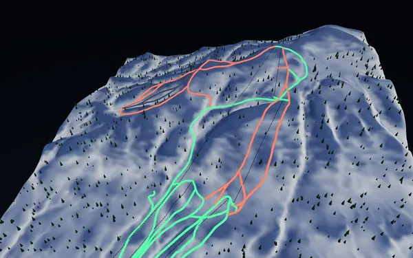
This 3D Kamui Ski Links map is built from a GSI elevation surface and OpenStreetMap piste and lift lines. The current snapshot spans roughly 70 to 794 metres elevation, with about 724 metres of mapped vertical. It includes 36 run lines and six lift lines: 22 are classified green, 12 red and two black in the source-derived display. That mix makes the lower and linking terrain visually distinct from the steeper upper options, but it does not replace the resort’s current course board. Run boundaries, grooming, closures and difficulty labels can change with conditions.
Use the relief view to compare the gondola fall line with the chair-served sides of the mountain. Named runs such as Next Step, Family, Shirakaba and Gold help anchor the view. Some controlled tree-skiing terrain may be offered by the resort, but access is governed by the resort’s current rules and closures. Do not infer that forest visible in the model is open terrain.
Access and timing
Kamui sits west of central Asahikawa and is commonly approached from the city by road or seasonal transport. The official site describes it as suitable for an Asahikawa day trip, but transport services and operating dates are seasonal, so verify the current timetable and reservation requirements directly. The main winter operating period is the natural time to use this ski map. For any particular day, check weather, wind, course status and the resort’s safety notices before leaving Asahikawa.