 出典:国土地理院 · © OpenStreetMap contributors / OpenSkiMap (ODbL)
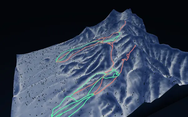
Furano · 3D map
Furano ski map and two-zone trail guide
Compare the Furano and Kitanomine sides across a near-1,000-metre mapped vertical.
- Elevation range
- 167–1,167 m
- Mapped vertical
- 1,000 m
- Run lines
- 56
- Lift lines
- 10
Reading the Furano map
Furano’s ski terrain is organised around the Furano and Kitanomine zones. SnowWind’s 3D map turns that two-zone layout into a relief model so the connection between the ropeway, gondola, link lifts and long descending pistes is visible at a glance. The current GSI and OpenStreetMap-derived snapshot ranges from roughly 167 to 1,167 metres elevation—almost 1,000 metres of mapped vertical—and contains 56 run lines and ten lift lines. Its source classifications include 33 green, 21 red and two black lines.
Use the green network to identify lower-gradient connections and base returns, then compare it with the red and black lines that descend more directly. Named landmarks include the Furano Ropeway, Kitanomine Gondola, Rinkan, Sailer and training or family runs. Map colour is only a broad category. Snow surface, grooming, closures and visibility can change the practical difficulty, so confirm the official trail status each day.
Access and trip timing
Furano can be approached through Furano town and regional road, rail or airport connections. Accommodation patterns differ between the Furano Zone side and Kitanomine, making the 3D map useful when comparing where a stay sits relative to the preferred lift base. Check current transfers and local transport with official providers, especially in winter weather. The core winter season suits piste and powder planning, while later periods can offer different visibility and surface conditions. There is no fixed best week: choose against your ability, preferred snow character and the current forecast rather than relying on a historical opening date.