 出典:国土地理院 · © OpenStreetMap contributors / OpenSkiMap (ODbL)
Asahidake · 3D map
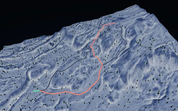
Asahidake Ropeway map and winter terrain guide
A mountain transport and terrain view—not a conventional groomed-resort trail map.
- Elevation range
- 664–1,755 m
- Mapped vertical
- 1,091 m
- Run lines
- 7
- Lift lines
- 1
What the Asahidake map represents
The Asahidake Ropeway rises into high mountain terrain on Hokkaido’s highest peak. SnowWind’s baked 3D surface spans roughly 664 to 1,755 metres elevation, with about 1,091 metres of mapped relief. Unlike a large piste resort, the source snapshot contains one ropeway line and only seven run or route lines. That sparse network is the key context: the map should not be read as a fully controlled ski-area diagram. Weather, wind, visibility, volcanic terrain and deep snow can make this environment serious even when the route geometry looks simple.
The A, B, C and D labels in the mapped data give orientation around the ropeway-served area. Green, red and black source categories help distinguish lines in the interface, but they are not an avalanche rating or live difficulty report. Leaving controlled or marked terrain requires backcountry skills, rescue equipment, current hazard information and an appropriate plan. Never use the 3D model as a substitute for local signage, patrol advice or navigation tools.
Access and seasonal planning
Visitors reach the mountain via the Asahidake Onsen road area and the Sanroku ropeway station; public transport and road conditions are seasonal, so confirm current access with the official operator. The winter snow period is the relevant time for skiing, while conditions and ropeway operation—not a generic “best month”—determine whether a visit is suitable. Check the weather and operating notice before departure, carry layers suitable for exposed alpine conditions, and be prepared to change plans. The model is most useful for understanding vertical scale, the single uplift corridor and the relationship between marked lines and surrounding mountain terrain.