 出典:国土地理院 · © OpenStreetMap contributors / OpenSkiMap (ODbL)
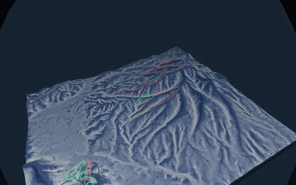
Rusutsu · 3D map
Rusutsu resort map and three-mountain orientation
Trace the lift and trail network across West Mountain, East Mountain and Mount Isola.
- Elevation range
- 307–992 m
- Mapped vertical
- 685 m
- Run lines
- 27
- Lift lines
- 18
How the Rusutsu map fits together
Rusutsu spreads its skiing across three mountain sectors rather than a single face. The SnowWind relief map helps separate West Mountain from East Mountain and Mount Isola, then shows how gondolas, chairs and runs connect within that geography. Its current GSI and OpenStreetMap-derived snapshot spans roughly 307 to 992 metres elevation, with about 685 metres of mapped vertical. It includes 27 run lines and 18 lift lines: ten green, 12 red and five black in the source categories.
Named lines such as Isola Grand, Heavenly View, Furikozawa, Rainbow and East Vivaldi make useful reference points. Green routes can help identify gentler progression and returns; red and black lines indicate stronger terrain in the map data. These colours do not report grooming, wind exposure, snow cover or whether a link is operating. Confirm the official trail map and current status, particularly before moving between mountain sectors.
Access and planning the day
Rusutsu is reached by road, with seasonal bus options commonly offered from Sapporo, New Chitose Airport and the wider ski region. Timetables, reservations and eligibility can change, so use the official access pages for the travel date. The main winter ski period is the practical season for this resort map, but the most suitable timing depends on snow, weather, visibility and the terrain you want. A first visit benefits from choosing one mountain sector as an anchor before exploring the full network. Use SnowWind to rehearse that spatial plan and the resort’s live information to decide what is actually open.