 出典:国土地理院 · © OpenStreetMap contributors / OpenSkiMap (ODbL)
Niseko United · 3D map
Niseko ski map, trail map and Hirafu orientation
Read the mountain as one connected landscape before choosing a base, lift or run.
- Elevation range
- 166–1,306 m
- Mapped vertical
- 1,140 m
- Run lines
- 162
- Lift lines
- 29
What this Niseko map shows
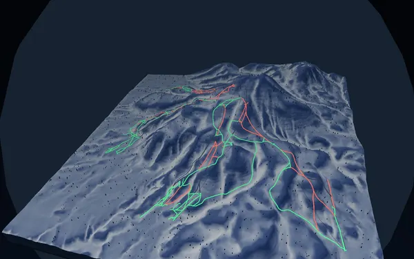
SnowWind’s Niseko ski map is a terrain-first view of the Niseko United side of Mount Annupuri. The baked map spans roughly 166 to 1,306 metres elevation and contains 162 mapped run lines and 29 lift lines from the current GSI and OpenStreetMap snapshot. Green, red and black classifications help separate gentler links from intermediate and advanced pistes, while the 3D relief makes the mountain’s ridges, fall lines and long traverses easier to understand than a flat trail map alone. Treat those colours as map categories, not a promise about grooming, snow quality or whether a run is open today.
The map covers the four main Niseko United sectors: Grand Hirafu, Hanazono, Niseko Village and Annupuri. Each has its own base, and the upper-mountain connections can depend on wind, visibility and lift operations. Use the resort switcher, run list and lift labels to rehearse a route, then confirm the current official trail map and lift status before setting out. Winter is the core ski period, but the useful part of the season varies with snowfall and operations; avoid planning around an assumed opening or closing date.
Hirafu and accommodation-map context
Grand Hirafu occupies the eastern side of the mapped area, with the Hirafu Welcome Center and mountain-base points shown where source data supports them. For a Hirafu ski map, begin by locating the Ace and King lift corridors, then trace how upper links lead toward Hanazono. Accommodation is spread through Hirafu village and the other resort bases. SnowWind is not a booking inventory or a complete Niseko accommodation map: building and facility labels come from OpenStreetMap and may be incomplete. Use them for spatial orientation, not availability. Access can be organised by road, bus or rail connections through the Niseko and Kutchan area; check the official operators for current reservations, stops and winter disruption before travel.